|
| *****SWAAG_ID***** | 671 |
| Date Entered | 10/01/2013 |
| Updated on | 10/01/2013 |
| Recorded by | Tim Laurie |
| Category | Burial Mounds and Cairns |
| Record Type | Archaeology |
| Site Access | Private |
| Record Date | 01/01/2013 |
| Location | Teesdale. High Conniscliffe, Low Carlbury Farm. |
| Civil Parish | Not known |
| Brit. National Grid | NZ 3534 4922 |
| Altitude | 42m |
| Geology | Drift over Magnesian Limestone. |
| Record Name | Smother Law or Carlbury. A Bronze Age round barrow on the North bank of the River Tees. |
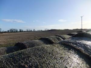
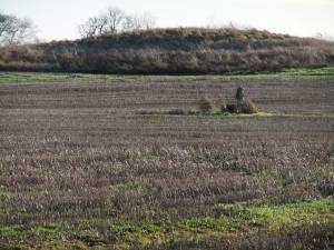
| Record Description | Round barrow, located on rising ground on the north side of the River Tees just 1KM NE of the two round barrows in Cliffe Park close to piercebridge, see also SWAAG Records 670 and 669. Visible as a turf covered mound 42m diameter diameter and 3m high (Young 1980). See photos. Reference:Young, R. 1980. An Inventory of Barrows in Co. Durham. Trans. Arch. and Archaeol. Soc. of Durham and Northumberland.1-16.
Dimensions
28m diameter and 1.5m high
Additional Notes
This is the third of at least 12 round barrows located close to the River Tees close to and up-river from Piercebridge. Several of these barrows are cup marked.
|
| Dimensions | 42m diameter and 3m high |
| Additional Notes | Local tradition affirms that an army (of 'Carles' perhaps) is buried here. (Young 1980). |
| Image 1 ID | 3928 Click image to enlarge |
| Image 1 Description | Carlbury or Smother Law photographed from the road at Carlbury Crossing |  |
| Image 2 ID | 3930 Click image to enlarge |
| Image 2 Description | Carlbury or Smother Law now in ploughed field. Detail. |  |

